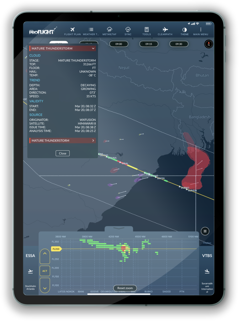
Real-Time thunderstorm information for all flight phases all over the globe. Precise hazard detection and forecasts up to 6 hours allow optimization of operational procedures and precautionary measures.
ProFlight utilizes real-time satellite-based CB cloud detection from WxFUSION to visually present convective turbulence and thunderstorm information to pilots.
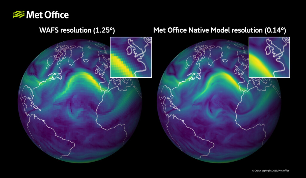
The UK Met Office is one of only two World Area Forecast Centers (WAFC) providing global aviation high-level weather information.
Recent advances in weather forecasting have made it possible to predict the horizontal and vertical distribution of turbulence. ProFlight uses this advanced forecast which is based on high-resolution models from the UK Met Office.
Gain access to 10 KM High-Resolution weather, and turbulence data in ProFlight.
Sign up for a trial and get 30 days free PREMIUM access
Get notified about new articles quarterly